GRANIT Municipal GIS Survey 2006/2007
About the Survey
The NH GRANIT at Complex Systems Research Center, University of New Hampshire, in collaboration with the
nine regional planning commissions (RPCs), has completed a survey of all municipalities in the state to better understand municipal tax parcel data holdings as well as related data sets.
The survey was designed to collect key information about digital tax parcel, zoning, elevation, and image data, including scale, resolution, accuracy, format, etc. We were also interested to know what municipal practices are in place relative to data maintenance, and whether data distribution policies have been developed.
GRANIT staff at Complex Systems Research Center designed the survey with input from the RPCs. RPC staff administered the survey to the towns within their planning regions over approximately a six month period from June, 2006 through January, 2007. Final survey results were compiled by GRANIT staff in March, 2007.
Acknowledgements
This work was funded by a grant from the NH GIS Conservation Collaborative. Additional resources were provided by FEMA through the Map Modernization
Management Support program. GRANIT would also like to thank the Regional Planning Commissions for the time and
effort they dedicated to this project.
Questions/Comments?
David Justice
GRANIT Project Director
Complex Systems Research Center
University of New Hampshire
Durham, NH 03824
david.justice@unh.edu
603-862-4698
Survey Results
Below is a subset of the results from the GRANIT Municipal GIS Survey. Please note that all graphs are based on a 93% response rate. Please click here to download the complete survey results (zipped MS Excel files). To download the survey instrument used as a MS Word document, please click here.
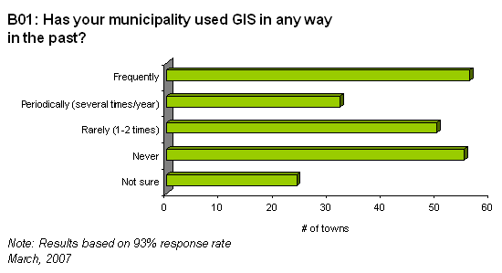
B01: See town list or map

B04: See town list or map
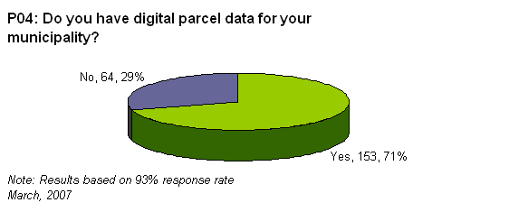
P04: See town list or map
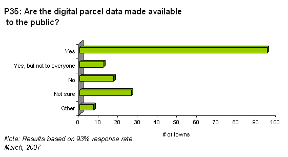
P35: See town list or map
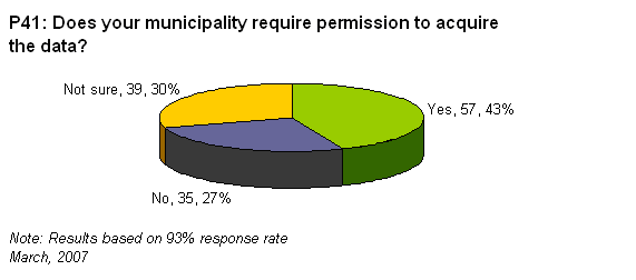
P41: See town list or map

P44: See town list or map
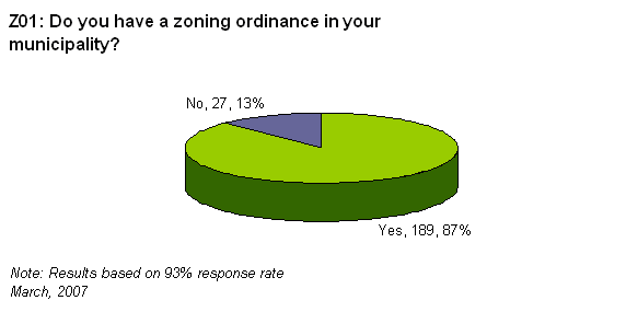
Z01: See town list or map
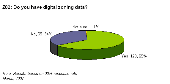
Z02: See a town list or map

E02: See town list or map

I05: See town list or map


